How a Large-Scale Palisades Fire Map Became an Emotional Centerpiece of the Recovery Effort
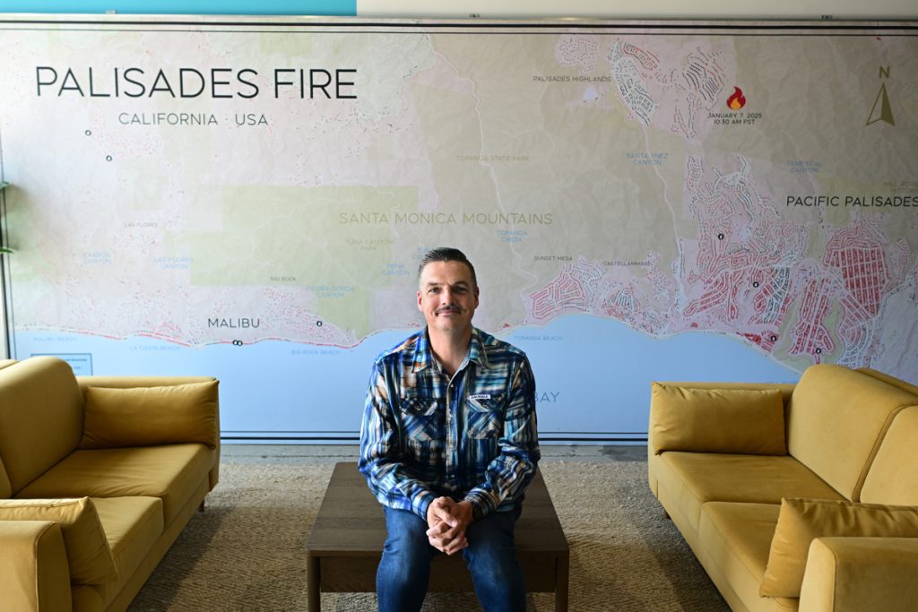
The massive fire map takes up an entire wall of the Malibu Community Long Term Recovery Group.
At 20 feet long and 8 feet tall, the map tells the story of the sprawling Palisades Fire in a way that is both visceral and clear, said Gus Peterson, executive director of the Malibu Community LTRG.
It has “singularly transformed our disaster recovery center,” and has become a focal point and an inspiration for fire survivors to share their stories, Peterson said.
“When I walk in, I am presented with the reality and the vastness and scope of what we are dealing with,” Peterson said. “When I see survivors walk in, they walk right towards the map and they point to where their house is or was and they start telling their story right away. It’s an immediate invitation that allows people to share what they want to share.”
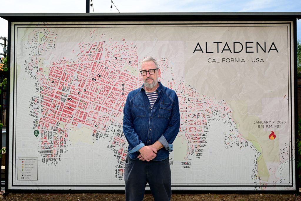
The map installation was made possible by local production designer Noel McCarthy, who also created the iconic large-scale Eaton Fire map in Altadena that has become a community cornerstone.
The California Community Foundation supports the Malibu LTRG as a fiscal sponsor. Rosemary Veniegas, senior vice president of impact and outcomes at CCF, said the map has proven to be a powerful tool for community healing in the wake of the devastating Palisades Fire.
“Folks touch these maps and tell the story of their loss,” Veniegas said. “It gives people a chance to be seen and heard in their own words.”
Last year, CCF launched the Community Healing and Restoration initiative with a consortium of funders and awarded more than $8 million in grants to over 60 programs dedicated to strengthening community bonds.
The Malibu LTRG is part of a coalition of organizations that work together to provide coordinated management of the long-term recovery of survivors of the Palisades and Franklin fires. It’s modeled on best practices promoted by National Voluntary Organizations Active in Disaster and is designed to take over after the Federal Emergency Management Agency, state agencies and insurers have largely finished their work, Peterson said.
“The structure and the intent of a long-term recovery group is ultimately so that the local community can own the local recovery,” he said.
The organization — housed inside the Boys & Girls Club of Malibu — has hired case managers and is identifying unmet needs of fire survivors, who are often fixed-income seniors and longtime residents facing six-figure rebuilding gaps after limited insurance payouts. Some of those cases will eventually be included in an unmet needs list that will be presented to philanthropic organizations that may be able to step in to fund the remaining shortfall.
Peterson’s own family sheltered in place at Pepperdine University as flames from the Franklin Fire in December 2024 came within 50 yards of their campus home. In the weeks after the Palisades Fire, he volunteered at the Boys & Girls Club’s disaster relief center. He later helped the group move from short-term aid to building a formal structure for long-term recovery, eventually helping write bylaws, facilitating early meetings and then stepping into the executive director role.
While the Palisades Fire map has now become the emotional and symbolic centerpiece of the Malibu LTRG’s disaster recovery center, it was actually gathering dust in storage last fall.
The story of how the map made its way to western Malibu started in the weeks after the L.A. County wildfires. That’s when local production designer Noel McCarthy took a work trip to Austin and someone asked him about the impact of the wildfires.
McCarthy pulled up the county’s online recovery map to explain the damage — but it wasn’t registering. Zoomed out, the official map was just a featureless red mass and zoomed in, it was too detailed and disjointed to convey the broader story.
McCarthy, 55, of Highland Park, realized the problem was scale and legibility. What people needed was a physically large, visually clear map that could communicate both the scope of destruction and the human lives behind it.
“And I’m a designer and visual communication — it’s how my brain works. To me, information visually expressed is a really high form of communication,” he said.
He and a graphic designer began stitching together screenshots from the map on the L.A. County Recovers website, building what became the Altadena fire map with red-colored icons for structures destroyed by the Eaton Fire. Printed and mounted on a custom-built wall, the map was displayed at Good Neighbor Bar in Altadena. It quickly turned into a gathering place for residents trying to make sense of their loss.
From the beginning, McCarthy saw the map serving two audiences — survivors and outsiders. For those whose homes were represented as burned lots on the board, it was a form of acknowledgment and validation. For visitors who hadn’t lived through the fire, it was an effective way to convey the scale of the disaster.
“It helps people tell their stories,” McCarthy said. “Literally, not a day goes by that somebody is not saying how important it has been in their processing of this whole thing and their recovery.”
McCarthy’s sister, a longtime leader at Heal the Bay, later urged him to replicate the project for the region impacted by the Palisades Fire, where no similar spot for community grieving existed. Funding was secured from L.A. County Supervisor Lindsey Horvath’s office to pay for the design.
The Palisades Fire map appeared last June at Heal the Bay’s aquarium and later at beach cleanups, but security and other hurdles in Santa Monica prevented a permanent public installation. For months, the map languished in the basement at Heal the Bay.
That changed when the Malibu LTRG reached out to McCarthy to see if they could use it for their recovery efforts. It quickly became a planning and storytelling tool, and also a reminder that the Palisades fire affected a larger region, Peterson said.
“One primary part of my role as executive director honestly is to remind people that Malibu was impacted. And this map very clearly shows that,” he said.
McCarthy recently sat in on a meeting with the Malibu LTRG and the map was referenced repeatedly during the discussion.
“It’s very gratifying to see something function exactly how you intended it to be. It helps people tell the story,” he said.
For more information about the Malibu LTRG, please visit malibucommunityltrg.org.
– Ben Poston